摘要:
如题。
如题。做了一个Demo,主要是把最后面的参考资料1里面的脚本改成了C语言版本的.
代码:


1 #ifndef __COORCONV_H__
2 #define __COORCONV_H__
3
4 #include <cmath>
5
6 double pi = 3.14159265358979;
7
8 /*Ellipsoid model constants (actual values here are for WGS84) */
9 double sm_a = 6378137.0;
10 double sm_b = 6356752.314;
11 double sm_EccSquared = 6.69437999013e-03;
12 double UTMScaleFactor = 0.9996;
13
14 typedef structtagUTMCorr
15 {
16     doublex;
17     doubley;
18 }UTMCoor;
19
20 typedef structtagWGS84Corr
21 {
22     doublelat;
23     doublelog;
24 }WGS84Corr;
25 /*
26 * DegToRad
27 *
28 * Converts degrees to radians.
29 *
30 */
31 inline double DegToRad (doubledeg)
32 {
33     return (deg / 180.0 *pi);
34 }
35
36 /*
37 * RadToDeg
38 *
39 * Converts radians to degrees.
40 *
41 */
42 inline double RadToDeg (doublerad)
43 {
44     return (rad / pi * 180.0);
45 }
46
47 /*
48 * ArcLengthOfMeridian
49 *
50 * Computes the ellipsoidal distance from the equator to a point at a
51 * given latitude.
52 *
53 * Reference: Hoffmann-Wellenhof, B., Lichtenegger, H., and Collins, J.,
54 * GPS: Theory and Practice, 3rd ed.  New York: Springer-Verlag Wien, 1994.
55 *
56 * Inputs:
57 *     phi - Latitude of the point, in radians.
58 *
59 * Globals:
60 *     sm_a - Ellipsoid model major axis.
61 *     sm_b - Ellipsoid model minor axis.
62 *
63 * Returns:
64 *     The ellipsoidal distance of the point from the equator, in meters.
65 *
66 */
67 double ArcLengthOfMeridian (doublephi)
68 {
69     doublealpha, beta, gamma, delta, epsilon, n;
70     doubleresult;
71
72     /*Precalculate n */
73     n = (sm_a - sm_b) / (sm_a +sm_b);
74
75     /*Precalculate alpha */
76     alpha = ((sm_a + sm_b) / 2.0) * (1.0 + (pow(n, 2.0) / 4.0) + (pow(n, 4.0) / 64.0));
77
78     /*Precalculate beta */
79     beta = (-3.0 * n / 2.0) + (9.0 * pow(n, 3.0) / 16.0) + (-3.0 * pow(n, 5.0) / 32.0);
80
81     /*Precalculate gamma */
82     gamma = (15.0 * pow(n, 2.0) / 16.0) + (-15.0 * pow(n, 4.0) / 32.0);
83
84     /*Precalculate delta */
85     delta = (-35.0 * pow(n, 3.0) / 48.0) + (105.0 * pow(n, 5.0) / 256.0);
86
87     /*Precalculate epsilon */
88     epsilon = (315.0 * pow(n, 4.0) / 512.0);
89
90     /*Now calculate the sum of the series and return */
91     result = alpha * (phi + (beta * sin(2.0 * phi)) + (gamma * sin(4.0 * phi)) + (delta * sin(6.0 * phi)) + (epsilon * sin(8.0 *phi)));
92
93     returnresult;
94 }
95
96 /*
97 * UTMCentralMeridian
98 *
99 * Determines the central meridian for the given UTM zone.
100 *
101 * Inputs:
102 *     zone - An integer value designating the UTM zone, range [1,60].
103 *
104 * Returns:
105 *   The central meridian for the given UTM zone, in radians, or zero
106 *   if the UTM zone parameter is outside the range [1,60].
107 *   Range of the central meridian is the radian equivalent of [-177,+177].
108 *
109 */
110 inline double UTMCentralMeridian (intzone)
111 {
112     return DegToRad(-183.0 + (zone * 6.0));
113 }
114
115
116 /*
117 * FootpointLatitude
118 *
119 * Computes the footpoint latitude for use in converting transverse
120 * Mercator coordinates to ellipsoidal coordinates.
121 *
122 * Reference: Hoffmann-Wellenhof, B., Lichtenegger, H., and Collins, J.,
123 *   GPS: Theory and Practice, 3rd ed.  New York: Springer-Verlag Wien, 1994.
124 *
125 * Inputs:
126 *   y - The UTM northing coordinate, in meters.
127 *
128 * Returns:
129 *   The footpoint latitude, in radians.
130 *
131 */
132 double FootpointLatitude (doubley)
133 {
134     doubley_, alpha_, beta_, gamma_, delta_, epsilon_, n;
135     doubleresult;
136
137     /*Precalculate n (Eq. 10.18) */
138     n = (sm_a - sm_b) / (sm_a +sm_b);
139
140     /*Precalculate alpha_ (Eq. 10.22) */
141     /*(Same as alpha in Eq. 10.17) */
142     alpha_ = ((sm_a + sm_b) / 2.0) * (1 + (pow(n, 2.0) / 4) + (pow(n, 4.0) / 64));
143
144     /*Precalculate y_ (Eq. 10.23) */
145     y_ = y /alpha_;
146
147     /*Precalculate beta_ (Eq. 10.22) */
148     beta_ = (3.0 * n / 2.0) + (-27.0 * pow(n, 3.0) / 32.0) + (269.0 * pow(n, 5.0) / 512.0);
149
150     /*Precalculate gamma_ (Eq. 10.22) */
151     gamma_ = (21.0 * pow(n, 2.0) / 16.0) + (-55.0 * pow(n, 4.0) / 32.0);
152
153     /*Precalculate delta_ (Eq. 10.22) */
154     delta_ = (151.0 * pow (n, 3.0) / 96.0)    + (-417.0 * pow (n, 5.0) / 128.0);
155
156     /*Precalculate epsilon_ (Eq. 10.22) */
157     epsilon_ = (1097.0 * pow(n, 4.0) / 512.0);
158
159     /*Now calculate the sum of the series (Eq. 10.21) */
160     result = y_ + (beta_ * sin(2.0 * y_)) + (gamma_ * sin(4.0 * y_)) + (delta_ * sin(6.0 * y_)) + (epsilon_ * sin(8.0 *y_));
161
162     returnresult;
163 }
164
165 /*
166 * MapLatLonToXY
167 *
168 * Converts a latitude/longitude pair to x and y coordinates in the
169 * Transverse Mercator projection.  Note that Transverse Mercator is not
170 * the same as UTM; a scale factor is required to convert between them.
171 *
172 * Reference: Hoffmann-Wellenhof, B., Lichtenegger, H., and Collins, J.,
173 * GPS: Theory and Practice, 3rd ed.  New York: Springer-Verlag Wien, 1994.
174 *
175 * Inputs:
176 *    phi - Latitude of the point, in radians.
177 *    lambda - Longitude of the point, in radians.
178 *    lambda0 - Longitude of the central meridian to be used, in radians.
179 *
180 * Outputs:
181 *    xy - A 2-element array containing the x and y coordinates
182 *         of the computed point.
183 *
184 * Returns:
185 *    The function does not return a value.
186 *
187 */
188 void MapLatLonToXY (double phi, double lambda, double lambda0, UTMCoor &xy)
189 {
190     doubleN, nu2, ep2, t, t2, l;
191     doublel3coef, l4coef, l5coef, l6coef, l7coef, l8coef;
192     doubletmp;
193
194     /*Precalculate ep2 */
195     ep2 = (pow(sm_a, 2.0) - pow(sm_b, 2.0)) / pow(sm_b, 2.0);
196
197     /*Precalculate nu2 */
198     nu2 = ep2 * pow(cos(phi), 2.0);
199
200     /*Precalculate N */
201     N = pow(sm_a, 2.0) / (sm_b * sqrt(1 +nu2));
202
203     /*Precalculate t */
204     t =tan (phi);
205     t2 = t *t;
206     tmp = (t2 * t2 * t2) - pow (t, 6.0);
207
208     /*Precalculate l */
209     l = lambda -lambda0;
210
211     /*Precalculate coefficients for l**n in the equations below
212 so a normal human being can read the expressions for easting
213 and northing
214 -- l**1 and l**2 have coefficients of 1.0 */
215     l3coef = 1.0 - t2 +nu2;
216
217     l4coef = 5.0 - t2 + 9 * nu2 + 4.0 * (nu2 *nu2);
218
219     l5coef = 5.0 - 18.0 * t2 + (t2 * t2) + 14.0 * nu2 - 58.0 * t2 *nu2;
220
221     l6coef = 61.0 - 58.0 * t2 + (t2 * t2) + 270.0 * nu2    - 330.0 * t2 *nu2;
222
223     l7coef = 61.0 - 479.0 * t2 + 179.0 * (t2 * t2) - (t2 * t2 *t2);
224
225     l8coef = 1385.0 - 3111.0 * t2 + 543.0 * (t2 * t2) - (t2 * t2 *t2);
226
227     /*Calculate easting (x) */
228     xy.x = N * cos (phi) * l + (N / 6.0 * pow(cos(phi), 3.0) * l3coef * pow(l, 3.0))
229         + (N / 120.0 * pow(cos(phi), 5.0) * l5coef * pow(l, 5.0))
230         + (N / 5040.0 * pow(cos (phi), 7.0) * l7coef * pow(l, 7.0));
231
232     /*Calculate northing (y) */
233     xy.y =ArcLengthOfMeridian (phi)
234         + (t / 2.0 * N * pow(cos(phi), 2.0) * pow(l, 2.0))
235         + (t / 24.0 * N * pow(cos(phi), 4.0) * l4coef * pow(l, 4.0))
236         + (t / 720.0 * N * pow(cos(phi), 6.0) * l6coef * pow(l, 6.0))
237         + (t / 40320.0 * N * pow(cos(phi), 8.0) * l8coef * pow(l, 8.0));
238 }
239
240
241
242 /*
243 * MapXYToLatLon
244 *
245 * Converts x and y coordinates in the Transverse Mercator projection to
246 * a latitude/longitude pair.  Note that Transverse Mercator is not
247 * the same as UTM; a scale factor is required to convert between them.
248 *
249 * Reference: Hoffmann-Wellenhof, B., Lichtenegger, H., and Collins, J.,
250 *   GPS: Theory and Practice, 3rd ed.  New York: Springer-Verlag Wien, 1994.
251 *
252 * Inputs:
253 *   x - The easting of the point, in meters.
254 *   y - The northing of the point, in meters.
255 *   lambda0 - Longitude of the central meridian to be used, in radians.
256 *
257 * Outputs:
258 *   philambda - A 2-element containing the latitude and longitude
259 *               in radians.
260 *
261 * Returns:
262 *   The function does not return a value.
263 *
264 * Remarks:
265 *   The local variables Nf, nuf2, tf, and tf2 serve the same purpose as
266 *   N, nu2, t, and t2 in MapLatLonToXY, but they are computed with respect
267 *   to the footpoint latitude phif.
268 *
269 *   x1frac, x2frac, x2poly, x3poly, etc. are to enhance readability and
270 *   to optimize computations.
271 *
272 */
273 void MapXYToLatLon (double x, double y, double lambda0, WGS84Corr &philambda)
274 {
275     doublephif, Nf, Nfpow, nuf2, ep2, tf, tf2, tf4, cf;
276     doublex1frac, x2frac, x3frac, x4frac, x5frac, x6frac, x7frac, x8frac;
277     doublex2poly, x3poly, x4poly, x5poly, x6poly, x7poly, x8poly;
278
279     /*Get the value of phif, the footpoint latitude. */
280     phif =FootpointLatitude (y);
281
282     /*Precalculate ep2 */
283     ep2 = (pow(sm_a, 2.0) - pow(sm_b, 2.0))    / pow(sm_b, 2.0);
284
285     /*Precalculate cos (phif) */
286     cf =cos (phif);
287
288     /*Precalculate nuf2 */
289     nuf2 = ep2 * pow (cf, 2.0);
290
291     /*Precalculate Nf and initialize Nfpow */
292     Nf = pow(sm_a, 2.0) / (sm_b * sqrt(1 +nuf2));
293     Nfpow =Nf;
294
295     /*Precalculate tf */
296     tf =tan (phif);
297     tf2 = tf *tf;
298     tf4 = tf2 *tf2;
299
300     /*Precalculate fractional coefficients for x**n in the equations
301 below to simplify the expressions for latitude and longitude. */
302     x1frac = 1.0 / (Nfpow *cf);
303
304     Nfpow *= Nf;   /*now equals Nf**2) */
305     x2frac = tf / (2.0 *Nfpow);
306
307     Nfpow *= Nf;   /*now equals Nf**3) */
308     x3frac = 1.0 / (6.0 * Nfpow *cf);
309
310     Nfpow *= Nf;   /*now equals Nf**4) */
311     x4frac = tf / (24.0 *Nfpow);
312
313     Nfpow *= Nf;   /*now equals Nf**5) */
314     x5frac = 1.0 / (120.0 * Nfpow *cf);
315
316     Nfpow *= Nf;   /*now equals Nf**6) */
317     x6frac = tf / (720.0 *Nfpow);
318
319     Nfpow *= Nf;   /*now equals Nf**7) */
320     x7frac = 1.0 / (5040.0 * Nfpow *cf);
321
322     Nfpow *= Nf;   /*now equals Nf**8) */
323     x8frac = tf / (40320.0 *Nfpow);
324
325     /*Precalculate polynomial coefficients for x**n.
326 -- x**1 does not have a polynomial coefficient. */
327     x2poly = -1.0 -nuf2;
328
329     x3poly = -1.0 - 2 * tf2 -nuf2;
330
331     x4poly = 5.0 + 3.0 * tf2 + 6.0 * nuf2 - 6.0 * tf2 * nuf2 - 3.0 * (nuf2 *nuf2) - 9.0 * tf2 * (nuf2 *nuf2);
332
333     x5poly = 5.0 + 28.0 * tf2 + 24.0 * tf4 + 6.0 * nuf2 + 8.0 * tf2 *nuf2;
334
335     x6poly = -61.0 - 90.0 * tf2 - 45.0 * tf4 - 107.0 * nuf2    + 162.0 * tf2 *nuf2;
336
337     x7poly = -61.0 - 662.0 * tf2 - 1320.0 * tf4 - 720.0 * (tf4 *tf2);
338
339     x8poly = 1385.0 + 3633.0 * tf2 + 4095.0 * tf4 + 1575 * (tf4 *tf2);
340
341     /*Calculate latitude */
342     philambda.lat = phif + x2frac * x2poly * (x * x) + x4frac * x4poly * pow(x, 4.0) + x6frac * x6poly * pow(x, 6.0) + x8frac * x8poly * pow(x, 8.0);
343
344     /*Calculate longitude */
345     philambda.log = lambda0 + x1frac * x + x3frac * x3poly * pow(x, 3.0) + x5frac * x5poly * pow(x, 5.0) + x7frac * x7poly * pow(x, 7.0);
346 }
347
348
349 /*
350 * LatLonToUTMXY
351 *
352 * Converts a latitude/longitude pair to x and y coordinates in the
353 * Universal Transverse Mercator projection.
354 *
355 * Inputs:
356 *   lat - Latitude of the point, in radians.
357 *   lon - Longitude of the point, in radians.
358 *   zone - UTM zone to be used for calculating values for x and y.
359 *          If zone is less than 1 or greater than 60, the routine
360 *          will determine the appropriate zone from the value of lon.
361 *
362 * Outputs:
363 *   xy - A 2-element array where the UTM x and y values will be stored.
364 *
365 * Returns:
366 *   void
367 *
368 */
369 void LatLonToUTMXY (double lat, double lon, int zone, UTMCoor &xy)
370 {
371 MapLatLonToXY (lat, lon, UTMCentralMeridian(zone), xy);
372
373     /*Adjust easting and northing for UTM system. */
374     xy.x = xy.x * UTMScaleFactor + 500000.0;
375     xy.y = xy.y *UTMScaleFactor;
376     if (xy.y < 0.0)
377         xy.y += 10000000.0;
378 }
379
380
381
382 /*
383 * UTMXYToLatLon
384 *
385 * Converts x and y coordinates in the Universal Transverse Mercator
386 * projection to a latitude/longitude pair.
387 *
388 * Inputs:
389 *    x - The easting of the point, in meters.
390 *    y - The northing of the point, in meters.
391 *    zone - The UTM zone in which the point lies.
392 *    southhemi - True if the point is in the southern hemisphere;
393 *               false otherwise.
394 *
395 * Outputs:
396 *    latlon - A 2-element array containing the latitude and
397 *            longitude of the point, in radians.
398 *
399 * Returns:
400 *    The function does not return a value.
401 *
402 */
403 void UTMXYToLatLon (double x, double y, int zone, bool southhemi, WGS84Corr &latlon)
404 {
405     doublecmeridian;
406
407     x -= 500000.0;
408     x /=UTMScaleFactor;
409
410     /*If in southern hemisphere, adjust y accordingly. */
411     if(southhemi)
412         y -= 10000000.0;
413
414     y /=UTMScaleFactor;
415
416     cmeridian =UTMCentralMeridian (zone);
417 MapXYToLatLon (x, y, cmeridian, latlon);
418 }
419
420 #endif //__COORCONV_H__
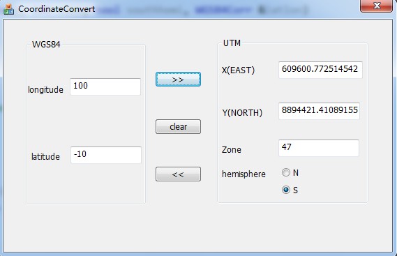
然后用MFC写了一个类似的对话框程序:
全部的源代码:
http://files.cnblogs.com/wb-DarkHorse/CoordinateConvert.rar
RERERENCE:
1http://home.hiwaay.net/~taylorc/toolbox/geography/geoutm.html 网页版demo
2http://www.mogoo.org/fang/?p=65 一位博客里面的,用Java写的
3http://en.wikipedia.org/wiki/Universal_Transverse_Mercator_coordinate_system wiki的介绍,公式都写的很清楚,不多说
4http://my.oschina.net/lidayong/blog/59869 一位博客里的,用c#写的
5http://www.zhdzch.com/xxyd/chzs/200904/522.html 比较清楚的介绍,用VB写的
下面是国外的几篇资料:
http://www.movable-type.co.uk/scripts/latlong-vincenty-direct.html根据经纬度求距离
http://www.ngs.noaa.gov/PUBS_LIB/inverse.pdf对应上面链接的文章
http://trac.osgeo.org/proj/一个开源的地图投影库